You are here
Insights on Khirbet Ain: from Bronze Age to Mamluk Era
By Saeb Rawashdeh - Nov 09,2024 - Last updated at Nov 09,2024

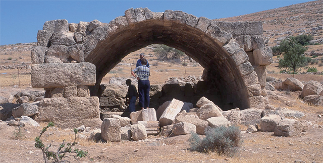
A Khirbet Ain tomb (Photo courtesy of APAAME)
AMMAN — The modern village of Khirbet Ain is located some seven kilometres southwest of Rihab, a hilly area with seasonal springs accessible by roads.
“Prominent remains in this region date back to at least the Bronze Age and dolmens are a common sight throughout the hills east of Jerash. As elsewhere in the wider region, the two periods of most extensive settlement in the past are the Late Bronze Age and the Roman period,” noted Ina Kehrberg-Ostrasz from The University of Sydney.
Rihab, known for its churches and mosaics, is in the same vicinity and arable land was used for agriculture in ancient times. The community of the area was prosperous and some of ruins include water reservoirs.
"Several Greek inscriptions have been published and pottery periods range from the Late Bronze Age through some Nabataean to Mamluk. But there are other sites like this of Roman period," said Kehrberg-Ostrasz, adding that travellers passed by to the west through Jerash or to the east along the line of the Pilgrim Road.
The route from Jerash to Mafraq has only become important in relatively recent times, and even the likely Roman road has not been traced.
“Despite its growing development in recent years, this area has been something of a void for scholars,” Kehrberg-Ostrasz continued, adding that neither Merrill nor Schumacher reached Khirbet Ain or its vicinity, the German scholars Brunnow and von Domaszewski did not get into this area in their search for Roman military sites, and the Princeton Expedition passed by on the east.
Khirbet Ain did not drag too much attention during 1930s, 1940s and 1950s when the Department of Antiquities was led by the British archaeologist Gerald Lankester Harding (1901-1979). The first record available is that of Nelson Glueck who was there on April 26 1944.
"Unfortunately, although Siegfried Mittmann visited many sites in the wider region, his important book [1970] does not include Khirbet Ain. It was only with Hanbury-Tenison [1987] that the site again received a mention in print. In the same period, Jean Sapin visited the site and made notes which are evidently the basis of the report on the site by Humbert in the volumes of The Archaeology of Jordan. Finally, the site is included in Zwickel's survey of Iron Age sites in Jordan," Kehrberg-Ostrasz elaborated.
The site lies in a valley running roughly east to west through which flows, seasonally, the Wadi Ulari. The Wadi Ain joins it from the north just downstream of the modern village of Khirbet Ain. The combined wadi later acquires further tributaries and, as the Wadi Khuraysan, flows into the Wadi Zerqa ten kilometres to the southwest.
"In the angle between the Wadi Ulari and the Wadi Ain are hills on a tongue of which lies the modern village. The south side of the tongue forms a semi-circular bowl up which the modern houses rise on a succession of zigzagging roads," Kehrberg-Ostrasz elaborated, adding that in a semi-circle around the top runs a ridge with extensive views.
The view, south from the village, is across the stream, the modern cemetery on and around the ancient tell and across fields of cereals and olives towards the next hillcrest, about a kilometre away, she said, adding that all the hills are around 800 metres high. Finds at Khirbet Ain cover the Chalcolithic, Early Bronze Age, Roman-Byzantine and Umayyad periods.
"Perhaps associated with this mound is the 'Egyptianising figurine' found by Sapin on the 'stairs' below the fortified site," Kehrberg-Ostrasz noted, adding that ground visits revealed an impressive structure, built of large rectangular limestone masonry blocks.
"Clearance by unknown explorers has recently exposed a doorway in the southern part of the west wall. The supposed inner enclosure may, in fact, be no more than the suggestive traces of buildings in the northwest quadrant,"Kehrberg-Ostrasz said.
There are other traces of foundation walls inside the large enclosure. The bare rocky area on the west side allowed water to drain down to another cistern just beyond the south-west angle. In the same place was seen a decorative masonry block implying something grander than a simple enclosure.
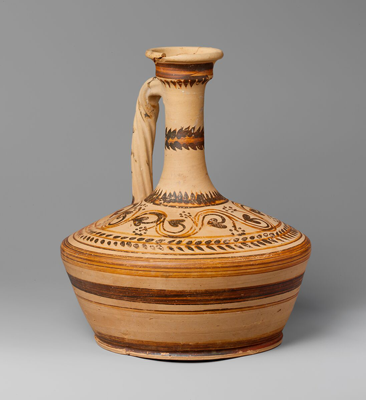
The date of the structure may be seen in very broad terms from sherds observed randomly by Kehrberg-Ostrasz: late second-first century BC Hellenistic; Eastern Terra Sigillata B (2nd century AD); imitation local Sigillata (1st /2nd century AD); some Late Roman (3rd century AD); much Late Byzantine (6th to 7th century AD), with glass; a few Islamic sherds, probably from Mamluk period.
The purpose of the structure remains unknown while archaeologists are trying to link pieces of a mosaic. It might be a fortification that was part of the frontier like much bigger site of Umm Jimal or Qasr Hallabat.
"This study has revealed Khirbet Ain and its vicinity as a significant and archaeologically rich place from at least the Bronze Age to the Early Islamic period. The twin peaks of settlement seem to have been the Iron Age and the Roman period. The latter in particular emerges now as one in which there was a probable military site on the ridge," Kehrberg-Ostrasz said.
Related Articles
AMMAN — Between Jerash, Mafraq and Zarqa lies a modern village named Khirbet Ain, located seven kilometres away from the well-known centre o
AMMAN — The Hellenistic period stretching from 323BC to roughly 30BC, between the death of Alexander the Great and the rise of the Rom
AMMAN — In the 1st century BC and 1st century AD, Gerasa (modern Jerash) had operational quarries, which are types of open-pit mines used fo


